
South America
Imagine you ask me for the most beautiful places in South America? What would be the most breathtaking moments during our trip? What would be my advice for you? Check this list of most beautiful places in South America. Enjoy!
Galapagos Islands, Ecuador
Galapagos Islands with its symbol – iguana. It’s a lovely place where animals and people live in perfect harmony. Thanks to the strongly respected animal protection, animals feel at home here. At a sight of a man, they will barely move. Iguanas, but also sea lions and pelicans. But be careful, in case of danger iguanas can spit ..

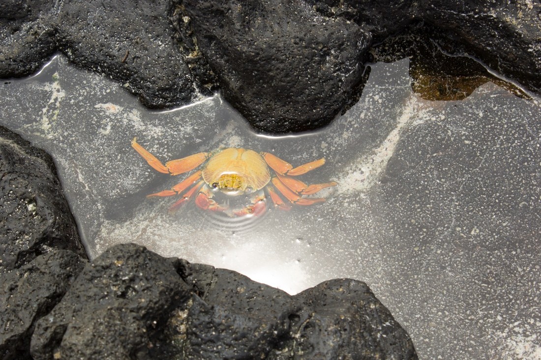
Crab, Galapagos, Ecuador
Red crab Grapsus grapsus, ubiquitous on the Galapagos Islands. It is hiding in the gap between volcanic rocks and is looking at us with one eye.
Land iguana, Galapagos, Ecuador
Land iguana is another symbol of the Galapagos Islands. This species is endemic, living in symbiosis with Darwin’s finches, feeding on all the vegetation of the Galapagos islands, including cacti. A land iguana is much harder to meet than a sea iguana. We met this specimen on the island of Seymour, next to blue-legged gannets and frigates with red balloons on the throat.

Isla Isabela, Galapagos, Ecuador
The Galapagos Islands are islands of volcanic origin. Many beaches are covered with wonderful, delicate sand, from which black and sharp rocks protrude. It’s lava. Marine iguana (iguana) feeds on algae that cover these volcanic rocks. It’s black so that you can barely see it.

Máncora, Peru
Máncora is located on the Pacific Ocean and it is one of the last places south of Ecuador, where the ocean is warm and the climate is very pleasant. It is a mecca for surfers and kite surfers. You can see lots of pelicans there, too.

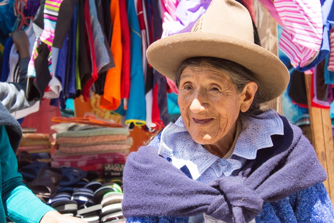
Cruz Pata village, north Peru
We are going to the mountainous village Cruz Pata to see the Karajía sarcophagi – the tombs of the Chachapoyas civilization. We drive for a long time on stony mountain roads of northern Peru. Finally, we get to a village with several houses around the main square. The kids run out of the car and find sticks and stones to play. We slowly pack things to set off on an hour route down the ravine, to the wall with sarcophagi. The villagers are sitting in front of their houses. We are as curious about them as they are about us. They are happy to pose for photos without stopping peeling corn.

Laguna Llanguanuco and Chinancocha, Peru
It takes us two days to reach the Llanguanuco lagoon. When we arrive, we admire turquoise water in the lagoon and the nearby mountains Huascarán and Huandoy. The legend says that Huascar and Huanda were children of the rulers of two kingdoms fighting each other. They fell in love and fled to live together. Soon, however, their fathers found them and imprisoned on two mountains facing each other. The lovers cried so much that their tears changed into glacier and they themselves changed into the mountains Huascarán and Huandoy.

Baños Termales de Chancos, Peru
During the trip we regularly visit hot springs. It is fun for the whole family and an opportunity to soak in warm water. Coming from Caraz to Huaraz, I see a sign “Baños termales”. We turn back and look for it. After about 30 minutes of driving we reach local hot springs. This is a place for locals, the prices are very low, whereas the astonishment on people’s faces is huge. We are here an attraction, so we can easily take pictures of people around, with the background of bathing suits and plastic flip-flops.
Nevado Pastoruri, Peru
We are going to see the Pastoruri glacier. We spend the night in Catac, near entrance to the Huascarán National Park. We park next to the police station because it seems to us that it will be a safe place as we arrived on the day of local fiesta. Unfortunately, a moment later some crew appears and builds a stage on the square next to us. Later that evening we hear a rock concert from the nearby stage. The next day we’re going to see the glacier. The views are breathtaking …

Puja, Cordillera Blanca, Peru
Puja (puya) is a giant plant that can reach a height of up to several meters. It grows only in Peru and Bolivia, at an altitude of 3-4 thousand. m.a.s.l. and can live for 100 years!

Corrida in Catac, Peru
In Catac there is a two-day fiesta. Yesterday, we witnessed fiesta on the streets and listened to a rock concert. Today there is corrida. Of course not all of us go to see it – it is too cruel for the kids and I do not approve. However Andrew wants to see it. The audience is full, the show starts with clowns and orchestra, followed by bloody spectacle … And in the background, beautiful Cordillera Blanca.

Islas Ballestas, Peru
It used to be the main source of income in Peru – islands full of bird guano, i.e. manure from bird droppings. However now the islands are a natural reserve and tourist attraction. In this area we can see many sea lions that lie awkwardly on the surrounding rocks and huge flocks of birds.

Islas Ballestas, Peru
Platforms for loading guano on ships. They once belonged to people, currently occupied by a multitude of birds.

Nazca, Peru
Geoglyphs or giant terrestrial signs visible only from a distance. In Nazca, geoglyphs are shaped like animals or geometrical figures. On this picture taken from a plane you can see a viewing platform for those who cannot afford flying and two geoglyphs nearby – Tree and Hands.

Alpacas, Peru
Alpacas are popular South American breeding animals. Their wool is delicate and very warm. They have colorful woolen strings on their ears – this is a designation of the family that owns the flock.

Canion Colca, Peru
One of the deepest canyons (left bank 3200m above the level of the Colca river, right bank as much as 4,200m), considered the second deepest in the world (after Cotahuasi canyon). The canyon slopes are dotted with farm plots here and there, probably with potatoe fields. The region is rich in flora and fauna as well as thermal waters. In 1979, a group of canoeists from Poland swam through the canyon as part of the Canoandes ’79 expedition, which 5 years later was entered into the Guinness Book of Records.

Canion Colca, Peru
Coming back from the canyon, we were surprised by the snow! Fresh, fine fluff covered the whole area. We stopped for a small snow battle only to hide in our camper a moment later and warm up in its interior.

Vicuña, Peru
Vicuña is a smaller cousin of alpacas, gwanakos and llamas. It is a small and slender animal, very well adapted to live in high Andes. This species is under protection, threatened with extinction by previous mass hunting. The animal is not easy to meet in South America.

Huyro, Peru
To a night sleep we park our motorhome on markets of small towns. Market squares seem to us to be quite a safe place, besides it is usually the best seat in the city. Here is morning in Huyro, on the road from Cuzco to Machu Picchu. In the background, a monument to the Inca ruler and the surrounding mountains. Kids play with sticks, stones and all available items. Meanwhile, I prepare pancakes and coffee.

Machu Picchu, Peru
One of the 7 New Wonders of the World, the city of Incas, located at an altitude of about 2400m above sea level. We got here via an alternative route to avoid expensive train and equally expensive night in Aguas Calientes. Unfortunately, only boys saw Machu Picchu – this is Dad with Kacper and Konrad. Our daughter got sick at night so the girls stayed at the campground.

Ollantaytambo, Peru
In Ollantaytambo there is a very well preserved fortress from the Inca times. It was one of the few places where the Incas were effectively resisting the army of conquistador Pizarr. Interestingly, it is the only Inca city still inhabited. We visited it during local holiday, all residents were dressed in bright red striped ponchos and pompoms. Here you see a meeting without barriers – kids always want to have fun together.

Titicaca lake, Peru
After reaching Puno, we decided to visit Lake Titicaca on the less tourist side. Local residents advised us the northern headland with villages of Capachica and Llachon. We decided to go all the way to the very end of the cape. We had to cover a rocky, dirty road, but as a reward we enjoyed lovely views of the island of Taquile.

Titicaca lake, Peru
Visitng floating islands of Uros (islas flotantes de los uros), which are artificial islands made of calamus. There are homesteads on the islands, one family in each, sometimes with a few hens around. Indians from the islands are happy to welcome tourists and carry out a small information and entertainment spectacle, and then they guide tourists to calamitous boats.

Salar de Uyuni, Bolivia
The largest and most highly situated (3650 m above sea level) salt desert with an area of 10,000 km². Here you can see the desert full of water because on previous days it rained heavily. In the background there are small salt mounds. This is a traditional way of drying the salt – the mounds are left for a few days, then dry salt is transported and sold.

Salar de Uyuni, Bolivia
Our camping on the salt desert next to the cactus island Isla del Pescado. This is the largest island in the desert, covered with giant cacti, which can reach up to 10 meters. In the evening we set up a small table, chairs and relax along with the guys from second motorhome.

Lamas, Bolivia
The first day of our 4-day trip from Uyuni to San Pedro de Atacama in Chile through the Reserva Nacional de Fauna park Andina Eduardo Avora. We pass beautiful pools where llamas graze and feed pink flamingos. The views change every now and then. In a moment we will pass bare rocks with fantastic shapes, carved out of water and wind. Then the green and red lagoon, geysers and hot springs…

Red canion in Reserve of Eduardo Avora, Bolivia
Next camping place – a canyon in the Reserva Nacional de Fauna reserve Andina Eduardo Avora. This place guarantees a bit of warm – we are sheltered from strong wind by rocks. Children pop out of the car and immediately start to play with stones. Our companions take climbing equipment and explore walls of the canyon. I do yoga while enjoying lovely, lunar view around.

Laguna Colorada, Bolivia
The red lagoon, one of the most famous places of the park Eduardo Avora. It owes its color to specific algae that color it with shades of brown, red and pink. It is also the residence of flamingos.

Geysers Sol de Mañana, Bolivia
Sol de Mañana geyser area, located at an altitude of 4850 m above sea level. In this place, the ground is punched with gaps, from which smoke or bubbling water emerges. There is smell of sulfur near the geysers. The landscape looks like from the times when the earth was in the process of formation.

Valle de la Luna, Chile
Moon Valley, or Calle de la Luna, located 13 km south of San Pedro de Atacama in Chile. This is a desert landscape with no trace of any plants nor animals. White traces are salt deposits from the Salar de Atacama desert.

Caleta Tumbes, Chile
A fishing town in the Bay of Conception (Bahía de Concepción) on Tumbes peninsula. On the shore of the ocean there are booths where you can buy fresh edible mussels (almejas) and cooked whole crabs or their tongs. We did not fail to buy and try.

Northern Patagonia, Argentina
Northern Patagonia is mountainous, full of greenery, rivers and lakes. It is intersected by winding roads that are called caracoles – snails. And in the distance you always see snowy peaks of the mountains.

Perito Moreno, Argentina
It was easy to get here. Everything is beautifully marked, there is a fee on the entrance gate, but a lot of additional information, a large parking lot and minibuses that take you around the place. The glacier itself, however, makes a big impression. It is huge, though distant and lives its life all the time. We can hear creaking sounds and bangs of breaking ice. The wind blows with great force in the ears. This is a feast for the eyes – Perito Moreno, one of the few glaciers that moves forward, not retracts.

Ice on Lago Grey, Chile
We hit Torres del Paine National Park at a bad time. The weather was terrible. Almost all the time was drizzling, which in combination with a strong Patagonian wind gives very unpleasant conditions. Everything around was gray, especially Lago Gray lake. Surprisingly, the pieces of glacier on the lake, even in this sad, gray weather, had an unreal, bright blue color.

Magellan Strait, Chile
We reach the point of Puerto del Hambre on the Strait of Magellan – a place where European settlers tried to set up a city, but they all died of starvation. Around we only see dry grass and colored algae. Strong wind is blowing and it is very cold – and this is mid of summer. Fortunately, our motorhome has good heating, which we use in Patagonia both day and night.

Children at Magellan Strait, Chile
Our house on wheels is a great solution for us, especially in windy Patagonia. Inside it is warm and comfortable, there is a place to cook and play plus a small toilet. But there are still interesting views outside of the window!

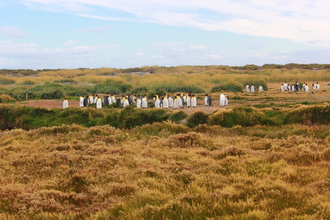
Royal penguins, Bahía Inútil, Chile
Coming to Ushuai, at the very end of Tierra del Fuego, we find out that in the area you can see the royal penguins in their natural habitat. We are going to the reserve to observe these huge birds.
Bahía Lapatía, Argentyna
We reach Parque National Tierra del Fuego, which is the National Park of Tierra del Fuego. The path is the farthest corner of the Lapatia bay. After a walk we will return to Ushuai, to our Couchsurfing hosts Andreas and Jade. We will spend the evening with them and listen to the history of the Jagan (Yámana) tribes who lived in boats, protected body from the cold with seal fat, and painted the body in very interesting patterns when conducting religious ceremonies. Currently only one representative of this tribe still lives.

Peninsula Valdés, Argentina
Peninsula Valdes on the Atlantic coast is rich in fauna and flora. Surrounded by stone and sandy cliffs, it is a great place to observe sea lions, sea elephants and penguins. You can also watch whales and orcs here if you are lucky. A lovely place with a much milder climate than Patagonia.


